
Copyright ©APKPanda. All Rights Reserved
您听说过Ventusky: Weather Maps - v14.0或Windy.com Weather Radar, Satellite and Forecast Premium APK MOD APK, Weather & Widget Weawow APK 已解锁 MOD APK, Ob havo o'zbekcha,
Windy.app v19.0.0 APK + MOD (Pro 已解锁)
MOD APK, WAFF 48 Storm Team Weather, Sense V2 Flip Clock & Weather Premium APK MOD APK,是类别天气中最酷的应用之一。
当然,您知道并非所有游戏或应用程序都兼容所有手机。游戏或应用程序有时在您的设备上不可用,这取决于系统版本。Android操作系统,屏幕分辨率或国家/地区Google Play允许访问。这就是APKPanda提供Android APK文件供您下载且不遵守这些限制的原因。>
Ventusky: Weather Maps - v14.0的最新版本为14.0,发行日期为2020-12-22,大小为34.1 MB。由InMeteo开发,Ventusky: Weather Maps - v14.0至少需要Android版本Android 4.4+。因此,如有必要,您必须更新手机。
负载量很大,大约有1000次下载。您可以根据需要更新已单独下载或安装在Android设备上的应用程序。更新应用程序使您可以访问最新功能,并提高应用程序的安全性和稳定性。
The app combines highly accurate weather forecast for your location with a 3D map showing development of weather in a broader area in a very interesting way. This allows you to see where precipitation is going to come from or where the wind is blowing from. The uniqueness of the app comes from the amount of data displayed. Forecast of weather, precipitation, wind, cloud cover, atmospheric pressure, snow cover and other meteorological data for different altitudes is available for the whole world.
WIND ANIMATION
The Ventusky application solves weather displaying in an interesting way. Wind is displayed using streamlines which clearly portray the continuous development of weather. Airflow on Earth is always in motion and the streamlines depict this motion in an amazing way. This makes the interconnection of all atmospheric phenomena obvious.
WEATHER FORECAST
Weather forecast for the first three days is available in the app in one-hour steps. For other days, it’s available in three-hour steps. Users can also look up sunrise and sunrise times in a given place.
WEATHER MODELS
Thanks to the Ventusky application, visitors get data directly from the numerical models that, just a few years ago, were used solely by meteorologists. The app collects data from the most accurate numerical models. Besides the well-known data from the American GFS and HRRR models, it also displays data from the Canadian GEM model and the German COSMO and particular ICON model, which is unique thanks to its high resolution for the whole world. Two models, EURAD and USRAD, are based on current radar and satellite readings. These models are able to show precisely current precipitation in US and Europe.
LIST OF WEATHER MAPS
• Temperature (15 levels)
• Perceived temperature
• Precipitation (1 hour, 3 hour, long time accumulation)
• Radar
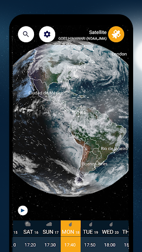
• Satellite
• Air quality (NO2, SO2, PM10, PM2.5, O3, dust or CO)
LIST OF PREMIUM WEATHER MAPS - PAID CONTENT
• Wind (16 levels)
• Wind gusts (1 hour, long time maximum)
• Cloud cover (high, middle, low, total)
• Snow cover (total, new)
• Humidity
• Dew point
• Air pressure
• CAPE, CIN, LI, Helicity (SRH)
• Freezing level
• Wave forecast
Do you have questions or suggestions?
Follow us on social media
• Facebook: https://www.facebook.com/ventusky/
• Twitter: https://twitter.com/Ventuskycom
• YouTube: https://www.youtube.com/c/Ventuskycom
Visit our website on: https://www.ventusky.com
We have started labeling all the pressure lows (as L) and highs (as H) arround the world! You can easily see where the center of the pressure system is located. It is wonderful and very practical to see where these systems are located.
Show moreOTHER VERSIONS