Copyright ©APKPanda. All Rights Reserved
Téléchargement Radlkarte Salzburg - v4.0 (31)
| Package Name | at.salzburg.radlkarte |
|---|---|
| Category | Applications, Plans et navigation |
| Latest Version | 4.0 (31) |
| Get it On |

|
| Update | February 18, 2021 (5 years ago) |
Vous avez entendu parler de Radlkarte Salzburg - v4.0 (31), ou Locus Map Pro Outdoor GPS navigation and maps APK Paid MOD APK, Bykea Partner, Genius Maps Offline GPS Navigation, Lalamove Driver - Earn Extra Income, GPS Emulator Pro APK v1.59 MOD APK, Wikiloc Outdoor Navigation GPS Premium APK MOD APK, l'un des Applications plus cool de la catégorie Plans et navigation.
Et bien sûr, vous savez que tous les jeux ou applications ne sont pas compatibles pour tous les téléphones. Le jeu ou l'application n'est parfois pas disponible sur votre appareil, cela dépend de la version du système. Système d'exploitation Android, résolution d'écran ou pays auxquels Google Play autorise l'accès. C'est pourquoi APKPanda fournit des fichiers APK Android que vous pouvez télécharger et ne respecte pas ces restrictions.>
Radlkarte Salzburg - v4.0 (31) la dernière version est le 4.0 (31), la date de sortie 2021-02-17 et la taille 16.6 MB.Développé par Verkehrsauskunft Österreich, Radlkarte Salzburg - v4.0 (31) nécessite au moins la version Android Android 5.0+. Par conséquent, vous devez mettre à jour votre téléphone si nécessaire.
Assez chargé, environ 1000 téléchargements. Vous pouvez mettre à jour les applications qui ont été téléchargées ou installées individuellement sur votre appareil Android si vous le souhaitez. La mise à jour de vos applications vous donne l'autorisation d'accéder aux dernières fonctionnalités et d'améliorer la sécurité et la stabilité des applications.
The app turns your smartphone into a GPS bike computer with useful features! Whether you're on your way to work, shopping or simply cycling for fun. The app brings you reliably to your destination.
APP FUNCTIONS:
- An optimized navigation for cyclists
- Easy selection or entry of addresses (starting point, destination point)
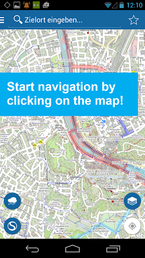
- Start your tour by simply clicking on the desired destination on the map
- Display of the last entered start and end points
- Simply add start and finish points to favorites to make them easier and faster to find
- Route: Determination of the recommended and shortest route
- Display of the route on the map
- Route: Display altitude profile, driving time, length, your arrival time and the remaining time and kilometers
- Routing instructions with image and text while driving on the map
- SPECIAL: Voice-guided navigation in German and English
- If there is a route deviation, this will be recalculated immediately
- Most accurate and up to date map and navigation base
- stops and departure monitor (S-Bahn)
- Display precipitation radar
No matter where you are traveling with your bike, you will be navigated as best you can to your destination.
We endeavor to continuously develop and improve the Radlkarte app.
We hope you enjoy cycling and are looking forward to your review.
Wir arbeiten laufend an der Verbesserung dieser App.
Show more