Copyright ©APKPanda. All Rights Reserved
Скачать Radlkarte Salzburg - v4.0 (31)
| Package Name | at.salzburg.radlkarte |
|---|---|
| Category | приложения, Карты и навигация |
| Latest Version | 4.0 (31) |
| Get it On |

|
| Update | February 18, 2021 (5 years ago) |
Вы слышали об Radlkarte Salzburg - v4.0 (31) или Genius Maps Offline GPS Navigation, Circuit Route Planner, Radarbot (MOD, Premium разблокирована) MOD APK, Wikiloc Outdoor Navigation GPS Premium APK MOD APK, Hammer Truck GPS Navigation App, Maps, & Routes, Jugnoo Drivers, одном из самых крутых приложения в категории Карты и навигация.
И, конечно, вы знаете, что не все игры или приложения совместимы со всеми телефонами. Игра или приложение иногда недоступны на вашем устройстве, это зависит от версии системы. Операционная система Android, разрешение экрана или страны доступ к которым разрешен в Google Play. Вот почему APKPanda предоставляет вам файлы APK для Android и не придерживается этих ограничений.>
Radlkarte Salzburg - v4.0 (31) последняя версия - 4.0 (31), дата выпуска 2021-02-17, размер 16.6 MBРазработано Verkehrsauskunft Österreich, Radlkarte Salzburg - v4.0 (31) требует версии Android не ниже Android 5.0+. Поэтому при необходимости вы должны обновить свой телефон.
«Довольно загружено, около 1000 загрузок. Вы можете обновлять приложения, которые были загружены или установлены индивидуально на вашем устройстве Android, если хотите. Обновление ваших приложений дает вам доступ к последним функциям и повышает безопасность и стабильность приложений».
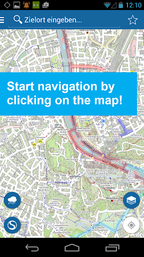
The app turns your smartphone into a GPS bike computer with useful features! Whether you're on your way to work, shopping or simply cycling for fun. The app brings you reliably to your destination.
APP FUNCTIONS:
- An optimized navigation for cyclists
- Easy selection or entry of addresses (starting point, destination point)
- Start your tour by simply clicking on the desired destination on the map
- Display of the last entered start and end points
- Simply add start and finish points to favorites to make them easier and faster to find
- Route: Determination of the recommended and shortest route
- Display of the route on the map
- Route: Display altitude profile, driving time, length, your arrival time and the remaining time and kilometers
- Routing instructions with image and text while driving on the map
- SPECIAL: Voice-guided navigation in German and English
- If there is a route deviation, this will be recalculated immediately
- Most accurate and up to date map and navigation base
- stops and departure monitor (S-Bahn)
- Display precipitation radar
No matter where you are traveling with your bike, you will be navigated as best you can to your destination.
We endeavor to continuously develop and improve the Radlkarte app.
We hope you enjoy cycling and are looking forward to your review.
Wir arbeiten laufend an der Verbesserung dieser App.
Show more